We’re traveling to the continent of North America for the next month.
First stop: Canada!
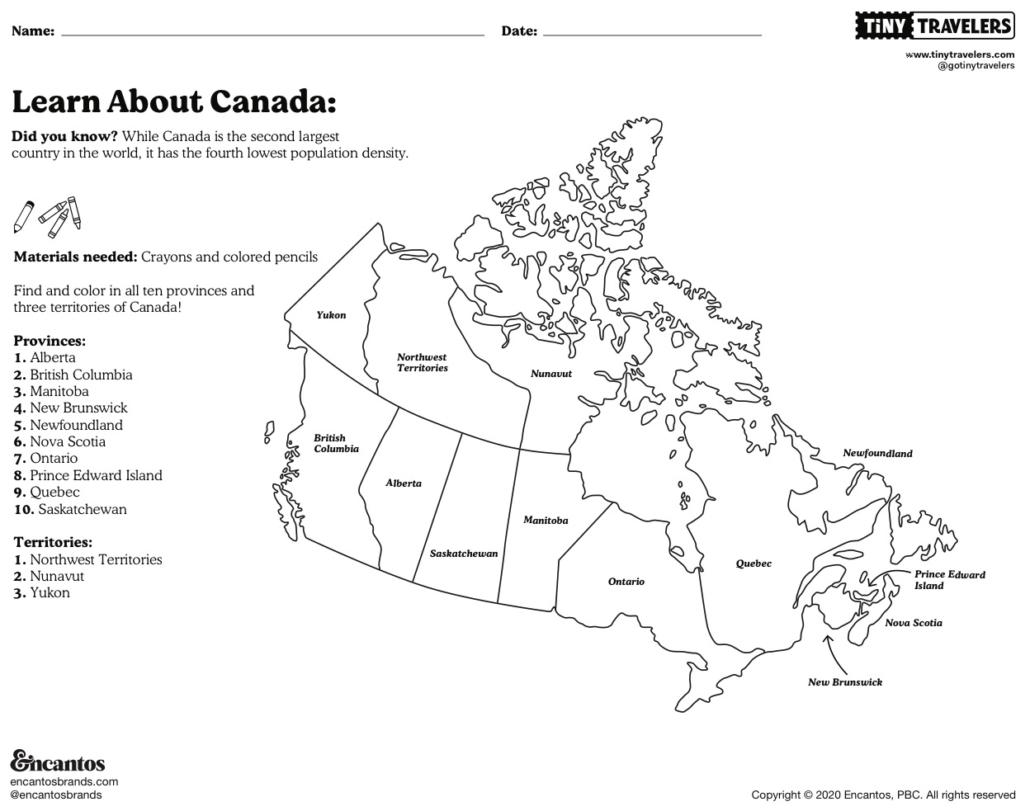
The second largest country in the world, Canada is known for its delicious maple syrup, beautiful natural landscape, hockey, and french and indigenous influences. There are 10 Canadian provinces: Alberta, British Columbia, Manitoba, New Brunswick, Newfoundland, Nova Scotia, Ontario, Prince Edward Island, Quebec and Saskatchewan, and three Canadian territories: Northwest Territories, Nunavut and Yukon.
For this week’s lesson you will color your own map of Canada, and find each province and territory. Before getting started you will need some crayons and pencils to color your map.