Learn About Lebanon: Nature!

Welcome to Lebanon, Tiny Travelers!

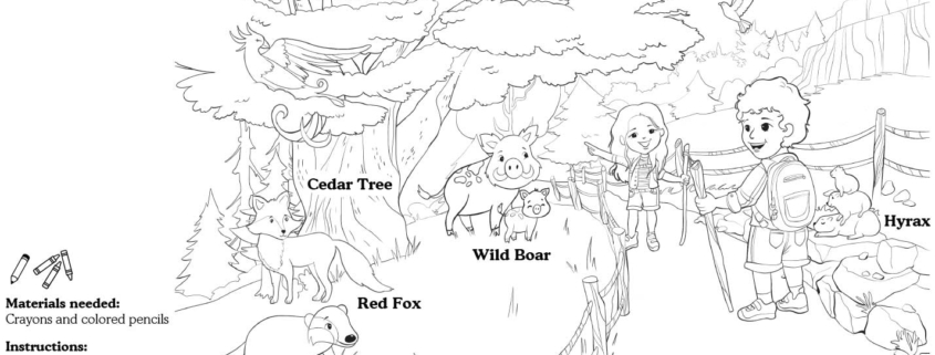
This week, we have a chance to add a splash of color to Lebanon’s Cedar Nature Reserve!

The largest of Lebanon’s nature reserves, Al-Shouf Cedar Nature Reserve stretches from Dahr Al-Baidar in the north to Niha Mountain in the south. The reserve hosts 32 species of wild mammals, of which 9 are considered to be rare at the international levels.

Cedar trees in Lebanon are special; we know they were used to build temples and ships long ago. In fact, some cedar trees are more than 3,000 years old WOW!which is why they symbolize resilience, immortality and strength. At the Cedar Nature Reserve, animals roam free. For this week’s lesson, you will color a scene from the Cedar Nature Reserve, including the following animals:

Wild boar

Red fox

Badger

Hyrax

And of course, a Cedar Tree. 

You might even hear the sounds of the reserve as you color this lovely scene from Lebanon and bring it to life!
Download Activity Sheet:


Learn about France: Architecture

Welcome to France, Tiny Travelers!

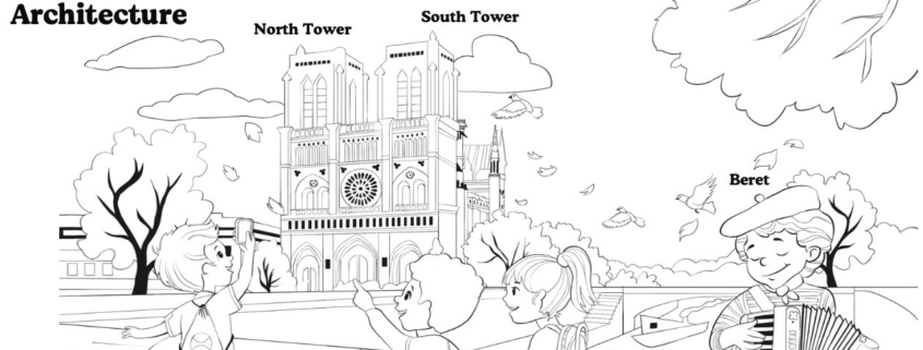
This week, we’re going to bring Notre Dame Cathedral to life! It is located in the capital of France, Paris, on a small island in the River Seine. 

There are lots of fascinating facts about this beautiful landmark to learn. The name “Notre Dame de Paris” literally means “Our Lady of Paris,” and the cathedral is famous for the story of the hunchback who once lived there and rang its bell! Have you heard of it? The hunchback must have been busy, because there are ten bells at Notre Dame, and they all have names — most of them come from Catholic saints, like Anne-Geneviève.

Notre Dame was built over 700 years ago, during the Middle Ages! It’s a great example of Gothic architecture, which you might recognize from dramatic features like stained glass windows (the cathedral has three, known as the rose windows), pointed arches, and elaborate decoration. 

For this week’s lesson let’s color a lively scene from the Notre Dame Cathedral in Paris, including the following elements:  

Accordion

South tower (right)

North tower (left)

River Seine

Beret


You might even feel a little gust of fall wind coming through as you color this lovely scene!


Download Activity Sheet:


Learn About Haiti: Culture!

Welcome to Haiti, Tiny Travelers!

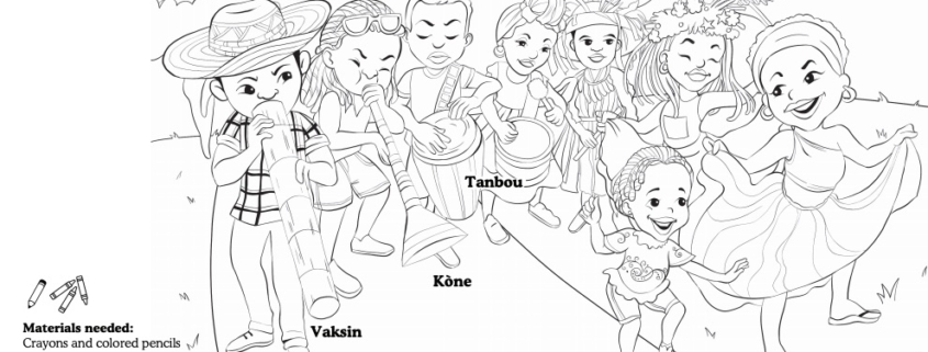
This week, we have a chance to add a splash of color to Haiti’s Rara festival! This carnival, which is full of lively street processions, embodies the musical spirit and vibrant culture of Haiti.

There are many elements that make up the ritualistic musical reunion that is Rara: woodwind instruments called vaksen or banbou, the metal-made trumpet kòne, different types of drums, maracas, grags (also called güiras), flutes, and much more! Streets are enveloped in song and melodies as Rara bands, some featuring only women, make their way through neighborhoods (sometimes for miles!), while parade-goers and fans partake by way of singing and dancing.

The vaksin or banbou are especially popular during Rara — they are long hollow tubes that serve as horns, and, depending on their size, create a different sound! Their unique sound is essentially synonymous to Rara. The tanbou, a barrel drum stemming from Haiti, which is carried cross-body, is also very much present, and it is said that the older the drum…the better the sound!

For this week’s lesson you will color a scene from the Rara carnaval, including the following elements:

Vaksin
Kòne
Tanbou
Chapo pay
Zwazo

You might even feel the music coming through as you color this lovely scene from the parade!


Download Activity Sheet:


Welcome to Egypt, Tiny Travelers!

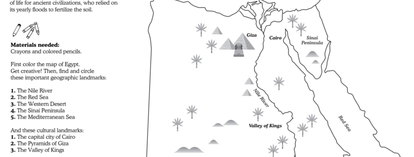
This week we we will continue to apply all of your learning about maps, geography, and land and water forms as we explore Egypt. Located in northeast Africa, Egypt has a desert climate of extreme hot during the summer and cold during the winter. Because Egypt only receives about one inch of rainfall each year, the Nile River is an important source of water, with annual floods that allow for crops to grow. These floods were crucial for the ancient civilizations that inhabited Egypt, which is why some of the most iconic historic sites are located near the Nile, such as the great Pyramids of Giza, the Sphinx, and the Valley of Kings, not to mention the capital city of Cairo. 

For this week’s lesson you will color a map of Egypt, then find and circle important geographic landmarks and cultural sites:

  1. The Nile River
  2. The Red Sea
  3. The Western Desert
  4. The Sinai Peninsula
  5. The Mediterranean Sea
  1. The capital city of Cairo 
  2. The Pyramids of Giza
  3. The Valley of Kings

Download Activity Sheet:


This week we are headed to the United States of America.

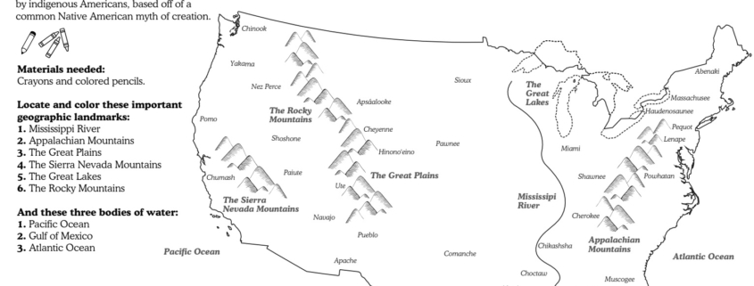
Before the arrival of Europeans, the land was inhabited by an estimated 50 million indigenous peoples, who lived in dozens of different tribes throughout the land. Today, the indigenous population is around 4.5 million, the result of disease and genocide committed by empires driven by their desire for conquest.

For this week’s activity you will color a map of the USA and identify key geographic landmarks, then find indigenous tribe names in a word search. This map of the United States shows the areas of land that were occupied by 34 indigenous peoples during the time before European settlers colonized North America, only a small portion of the tribes that used to live on this land. It is important to note that many indigenous populations have been known by different names, many of which are not what they refer to themselves as. For this reason you may not recognize all of the tribe names on this map. Try and see what you can learn about the names you don’t know.

Indigenous peoples – a term of self-identification that describes a person/people who have a long history living in and strong link with a specific territory, who have distinct cultures and societies, that pre-date colonial settlement

Genocide – the organized killing of a group of people, because of their race, religion, culture or nationality

Empire – one ruler who gathers and controls a group of territories or peoples

Conquest – to gain something (in this case, land), often with force and violence

Resources/Further Reading


Download Activity Sheet:


We’re traveling to the continent of North America for the next month.

First stop: Canada!
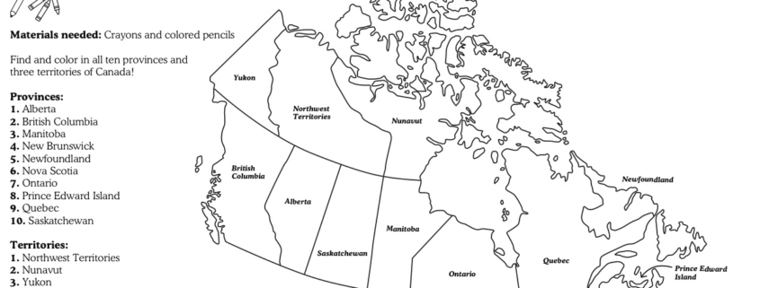
The second largest country in the world, Canada is known for its delicious maple syrup, beautiful natural landscape, hockey, and french and indigenous influences. There are 10 Canadian provinces: Alberta, British Columbia, Manitoba, New Brunswick, Newfoundland, Nova Scotia, Ontario, Prince Edward Island, Quebec and Saskatchewan, and three Canadian territories: Northwest Territories, Nunavut and Yukon.

For this week’s lesson you will color your own map of Canada, and find each province and territory. Before getting started you will need some crayons and pencils to color your map.


Download Activity Sheet:


This week we’re journeying to a new destination, Japan!

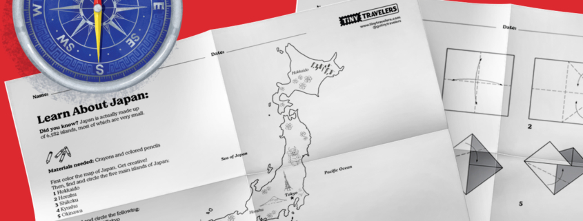
Japan is actually a string of islands in the Pacific ocean, located just off the east coast of Asia. There are five main islands: Hokkaido, Honshu, Shikoku, Kyushu and Okinawa, in addition to several smaller islands. The geography of Japan is made up of mostly mountains, with many volcanoes as well! The most well-known volcano is Mount Fuji, which is the highest peak in Japan at an elevation of 12,388 feet. Not too far from Mount Fuji is the capital city of Tokyo, home to over 36 million people, making it the largest metropolitan area in the world!

In today’s lesson, color your own map of Japan, then learn how to make your own origami fish! Origami is the art of paper folding, which has been practiced in Japan for over 300 years. Before you get started on these activities, you will need some crayons or pencils to color your map, and a square sheet of paper for your origami.

First, color your map, then find and circle the following:

The five main islands of Japan:
1) Hokkaido, 2) Honshu, 3) Shikoku, 4) Kyushu and 5) Okinawa

Then, find and circle:
1) the capital city of Tokyo, 2) Mount Fuji, 3) the Pacific Ocean

Next, grab a square sheet of paper, and follow the instructions on the worksheet to create your own origami fish.


Download Activity Sheet:


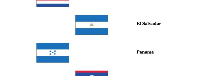
In today’s lesson, you will make a flag banner for the countries in Central America.

The three stripes (blue, white, blue) are common in many Central American flags. For example, in the Salvadoran flag, the royal blue shade was chosen to represent the oceans and sky of Central America. The white represents unity and peace. In Guatemala’s flag, the blue stripes represent the two oceans on each side of the country, the Atlantic and Pacific oceans.
Today, let’s bring the flags of Central America to life! Using the examples provided, create, and color your own flags. When you’re done, cut them out and string together to form your own flag banner!

Instructions:

  1. Color the country flags to match the flag examples. Then, cut out each flag.
  2. Decide where you will put your flag garland and cut a piece of yarn for the size that you want.
  3. Cut the fold over the top area of the flag and hook it over the piece of yarn.
  4. Tape the folded part to the back of the flag.
  5. Add each flag to your banner string.

If you need more string, cut more yarn and tie a knot to tie the string together.


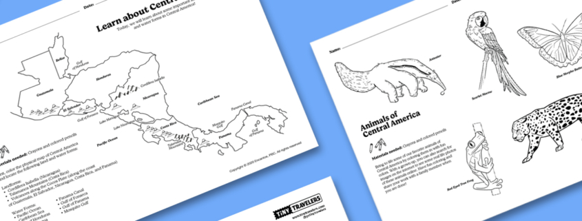
In today’s lesson, we will explore the geography of Central America.

With our coloring sheet, see if you can color and find some important land and water forms in Central America. Also, with a second fun coloring activity, get to know the countries and animals that make up this beautiful region! Before you begin, check out our Lesson Guide download for an overview of today’s lesson from a teacher!


In today’s lesson, we will continue to apply your learning about maps, geography, and land and water forms as we explore the Caribbean Islands.

In lesson 6, we learned about some land and water forms that include a landform called an archipelago. An archipelago is a group of islands that are close together. That is why the islands in the Caribbean are called the Caribbean Archipelago. Did you know that there are over 7,000 islands in the Caribbean archipelago? There are 13 countries in the Caribbean and 12 territories! A territory is an extension of other countries. In the Caribbean, there are three main ecosystems such as forests, coastal areas, and wetlands full of wildlife, from birds to reptiles, and sea creatures!

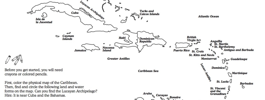
Today, you will color a map of the Caribbean islands and find some land and water forms in the region. Then, you can color some of our favorite animals of the Caribbean! Before you get started, you will need crayons or colored pencils to color the map.

First, color the physical map of the Caribbean. Find and circle the following water forms on the map:

Landforms

  • Lucayan Archipelago
  • Greater Antilles
  • Lesser Antilles

Water Forms

  • Straits of Florida
  • Gulf of Mexico
  • Atlantic Ocean
  • Caribbean Sea