Posts

Bienvenido a Mexico, Tiny Travelers! Did you know, Mexico is located on the continent of North America?

In Mexico, they speak Spanish so let’s get to know some Spanish words with a fun video from Canticos! In “Weather the Weather” or “Jaraba Tapatío,” our learners will learn about all kinds of weather through one of Mexico’s most famous songs. Check it out now!

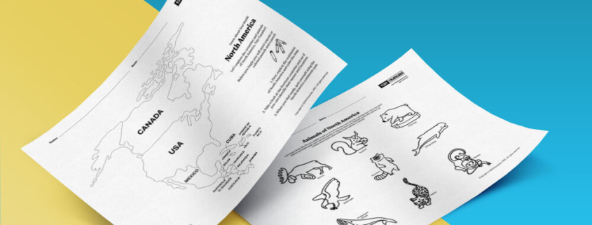
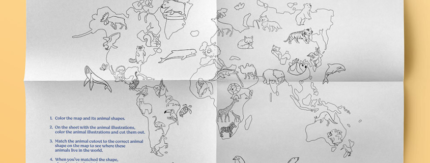
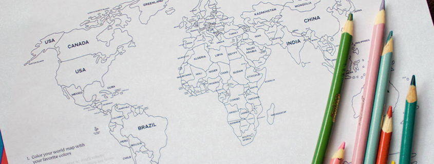
In today’s lesson, we will bring together some of the things you learned about maps, geography, and land and water forms as we explore Mexico. In Mexico, there are many high mountains throughout the country, vast deserts in the north, and lush green rain forests in the south and in the east.

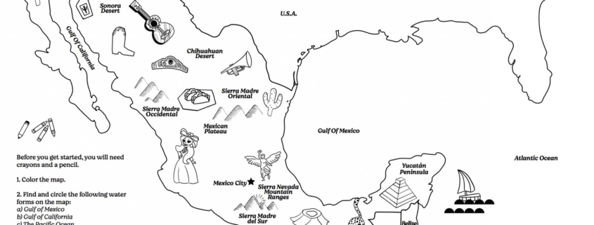
Before you get started, you will need crayons and a pencil.

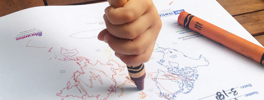
First, color the physical map of Mexico.

Next, find and circle the following water forms on the map:
1) the Gulf of Mexico
2) the Gulf of California
3) the Pacific Ocean

See if you can also find and circle the following landforms:
1) The Mexican Plateau
2) the Sonoran Desert and the Chihuahuan Desert
3) Sierra Madre Occidental, Sierra Madre Oriental, Sierra Madre del Sur, Sierra Nevada Mountain ranges
4) the Yucatan Peninsula


Download Activity Sheet:


Note to parents

There are a lot of Mexico specific land and water forms to explore in this map.


Before you begin you will need crayons or colored pencils and a pencil.

First, explore the continents of North America. Take a look at the fourteen countries. See what countries you already know about and look for the names of new countries that you might just be learning about for the first time. Find their locations and when you feel ready, quiz yourself using the North America continents quiz.

When you are ready to move onto the next activity, take a look at the animals of North America map and give them some color to bring them to life!


Download Activity Sheet:


Note to parents

Some children will benefit from reading aloud the directions and making sure they know what each ocean is and how to color it accordingly. Of course, there can be slight variations on the colors if you do not have one of the shades of green or blue. The main idea is that children understand even though it looks like one big body of water, there are names to different oceans around the world.


Before you begin you will need crayons or colored pencils, scissors, and a glue stick.

We’ll use pictures and symbols to tell a story about the people who live there and create a fun treasure hunt that you can play with other family members.

1) Start with drawing a map of your home. Check out the map examples for some inspiration!

2) Next, draw or cut out pictures and symbols to tell a story about the people who live in your home.

3) Then, add some of the “special symbols” to make your home map into a treasure map!

4) Add a map key with symbols, lines, special shapes, and colors to help readers make sense of the map.

5) You can also use some of the treasure chests or x’s provided to mark the placement of your first treasure.

6) You can make this into a game and hide objects for a treasure hunt game with family members.


Download Activity Sheet:


Note to parents

Be sure to help children identify the locations of countries by pointing at the countries and calling out their names aloud. You can also pull out any atlases at home and check out other maps of North America online. Ask your child if there are any countries that they are just learning about and see if they can locate it on the map.


What is a compass rose?

A compass rose is a drawing that is usually found on maps to show the cardinal directions, north, south, east, and west. Have you ever looked at a map and said, “the United States of America is above Mexico?”

But if you are in Mexico and looked up you wouldn’t see the United States. Instead, it is better for us to say that the United States of America is north of Mexico. The most northern point on our planet is the North Pole and the most southern point is the South Pole.

When facing north, east would be left in relation to where you are standing, and when facing north, west would be to the left.

Before you create your own compass rose style, check out the examples for some inspiration.


Download Activity Sheet:


Note to parents

See if you can play a game with your child saying what countries are east and west, and north and south of each other using a political map and a compass rose.. For example: “I spy with my little eye a country that is south of the United States of America.” See if they can find Mexico or any country that is south of the United States of America. You can also use hints using family members or friends that are from or live in different parts of the world; for example, “I spy a country that your grandfather is from that is east of Brazil.”


Now, that you have learned about the different continents and the countries within them, let’s learn about the oceans of the world.

There are seven continents and five oceans on the planet. Before you get started, you will need five different colored crayons or colored pencils in various shades of blue and green as outlined in the instructions.

Color each ocean as follows:

  • Pacific Ocean: Teal or Turquoise
  • Atlantic Ocean: Dark Blue
  • Indian Ocean: Blue
  • Arctic Ocean: Light Blue
  • Southern Ocean: Light Green

Then, cut out some of the ocean animals provided (sheet 3) and add them to your map! You will need a glue stick and scissors for this part.


Download Activity Sheet:


Note to parents

Some children will benefit from reading aloud the directions and making sure they know what each ocean is and how to color it accordingly. Of course, there can be slight variations on the colors if you do not have one of the shades of green or blue. The main idea is that children understand even though it looks like one big body of water, there are names to different oceans around the world.


Let’s get to know where some of our favorite animals live in the world!

Before you begin, you will need markers or crayons, scissors, and glue.

1) Color the map and its animal shapes.
2) On the sheet with the animal illustrations, color the animal illustrations and cut them out.
3) Match the animal cut out to the correct animal shape on the map to see where these animals live in the world.
4) When you’ve matched the shape, glue the animal to its home!

Why do you think some animals live in only some parts of the world? What are some animals that live near water or in the water?


Download Activity Sheet:


Note to parents

Use this as a jumping-off point to discuss differences in weather or terrain. You could also talk about how animals need to live in certain climates to survive and live happy lives.


Today, let’s take a look at a political map.

Political maps show you the borders of different countries. Before you begin, you will need crayons of all colors and for the second part of the activity, you will need an orange, green, blue, purple or pink, and black marker. Grab an atlas as well so you can see the names of the countries!

1) Color your world map.
2) Then, when you are done, draw a star or place a dot with an orange marker on the countries where you have family members living today or where they are from. Ask a family member where your parents, grandparents, aunts, uncles, cousins live today or might be from.
3) With a green marker, draw a circle on the countries where you have family friends or friends living today.
4) With a blue marker, make a check or place a dot to countries you have visited.
5) With a purple or pink marker place a heart on the countries you would like to visit someday.
6) With a black marker place a question mark of at least 3 places that you would like to learn more about.


Download Activity Sheet:


Note to parents

Help your kids think about family and friends, where they live and where they are from. Remind them of the places they have visited and ask them where they would love to travel to someday. Ask them what they are curious about. Then, help develop inquiry by asking them what places they would like to learn more about and why? What questions do they come up with?


Now that you’ve learned the names of the continents through your coloring activity, see if you can correctly name them here on this Continents Quiz Map.

Grab a pencil and a printed copy of this Continents Map Quiz and see if you can correctly name each continent by the number on the map.

Be sure to turn over your previous map- no peeking allowed!

Did you get all seven right?


Download Activity Sheet:


Note to parents

Use the answer sheet to show learners the correct continent names once they have completed the activity.


Let’s learn about the seven different continents.

Before you begin, you will need yellow, blue, green, orange, red, pink, and white or gray crayons or colored pencils.

Color the Continents in the Following Colors:

  • Africa: Yellow
  • North America: Blue
  • South America: Green
  • Europe: Orange
  • Asia: Red
  • Australia: Pink
  • Antarctica: White

Download Activity Sheet:


Note to parents

This is a great introductory lesson to teach basic geography skills to preschool and kindergarten learners. Kids will learn the names and locations of each continent with this fun coloring activity.