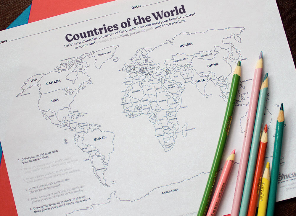
Today, let’s take a look at a political map.
Political maps show you the borders of different countries. Before you begin, you will need crayons of all colors and for the second part of the activity, you will need an orange, green, blue, purple or pink, and black marker. Grab an atlas as well so you can see the names of the countries!
1) Color your world map.
2) Then, when you are done, draw a star or place a dot with an orange marker on the countries where you have family members living today or where they are from. Ask a family member where your parents, grandparents, aunts, uncles, cousins live today or might be from.
3) With a green marker, draw a circle on the countries where you have family friends or friends living today.
4) With a blue marker, make a check or place a dot to countries you have visited.
5) With a purple or pink marker place a heart on the countries you would like to visit someday.
6) With a black marker place a question mark of at least 3 places that you would like to learn more about.