Posts

In today’s lesson, we will continue to apply your learning about maps, geography, and land and water forms as we explore Puerto Rico.

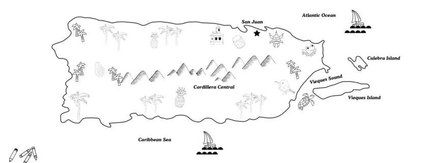
One very important landform in Puerto Rico is the mountain range known as Cordillera Central. These incredibly lush mountains in the center of Puerto Rico run the length of the country from east to west. Bananas, pineapples, and plantains are grown throughout the region as well as coffee. The beaches and coastlines of Puerto Rico are also some of the most beautiful in the world! The important water forms include the Atlantic Ocean in the north, the Caribbean Sea in the south, and the Vieques Sound between mainland Puerto Rico and the island of Vieques in the east. A sound is a waterform that is located along a coastline and it is a narrow sea or ocean channel between two bodies of land.

Today, you will color a map of Puerto Rico. Once you’re done, follow the guide to create a 3D salt dough map of Puerto Rico as well!

Before you get started, you will need crayons or colored pencils to color the map.

First, color the physical map of Puerto Rico.

Find and circle the following water forms on the map:
1) The Atlantic Ocean
2) The Caribbean Sea
3) The Vieques Sound

Then, find and circle the following landforms:
1) Cordillera Central Mountains
2) Vieques Island
3) Culebra Island
Download Activity Sheet:


Did you know that chocolate originates from Mexico?

The Olmecs of southern Mexico were probably some of the first people to grind cacao beans to make a chocolate drink for rituals and medicine almost 4,000 years ago! Aztec and Mayan people also used chocolate. Mayans have an earth goddess and goddess of the cacao tree that they called Ixcacao pronounced like eesh-cah-cow. Can you say that? IX means ‘her’ while cacao, of course, means ‘chocolate.’ Ixcacao was often called into prayer along with the corn mother and the rain god.

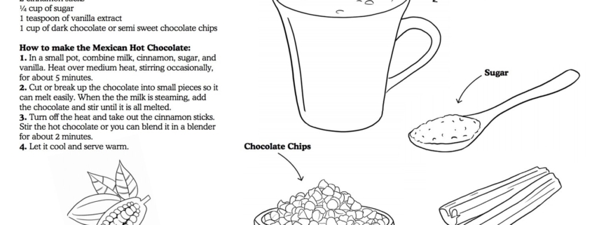
In today’s lesson, get to know the different foods of Mexico with a fun coloring sheet! Then, learn how to make Mexican hot chocolate with a grown-up using our favorite recipe. Did you know that in Mexico people sometimes use this wooden whisk called a Molinillo that makes the chocolate foamy? Also, in some parts of Mexico, hot chocolate is made with water and not milk, which makes each drink taste different. Lastly, people in Mexico don’t use a lot of sugar so that you can taste a bit of the spice from the chocolate itself.


Download Activity Sheet:


Note to parents

Note to Grown Ups: This recipe should be done with adult supervision as it involves heating milk and chocolate on a stove top.


Did you know that Mexican wrestling as we know it today, found its popularity as a sport in the early 1900s?

The origins of the freestyle wrestling form, lucha libre, which literally translates to “free fight” go all the way back to 1863. That’s over 150 years of a Mexican wrestling tradition!

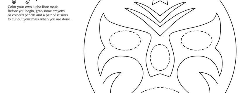
Today’s activity is to create your own lucha libre mask and to color a lucha libre wrestling scene. Before you begin, grab some crayons or colored pencils and a pair of scissors to cut out your mask when you are done.


Download Activity Sheet:


In Mexico, one of the most studied salamanders in the world are known as Axolotls.

Wild axolotls live in swampy areas of Lake Xochimilco and in the canals that flow into the southern edge of Mexico City.

Axolotls have also been known to have once lived in Lake Chalco, one of Mexico City’s five “great lakes”. This is one of the areas that the Aztecs settled. The Aztec called themselves Culhua-Mexica and they were a Nahuatl-speaking people who ruled a large empire in what we now call central and southern Mexico. The Axolotl name comes from the Nahuatl language and is pronounced Ax-oh-lot-ul. Atl means “water” and axolotl means “dog,” after the Xolotl, the canine Aztec deity.

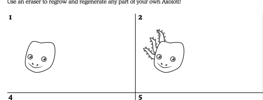
In today’s lesson, we will learn how to draw your own Axolotl!

Before you begin, you will need a pencil, eraser, and colored pencils or crayons.

1) Did you know: Even though the Axolotl is commonly known as a “Mexican Walking Fish” it is not a fish at all. Axolotls are salamanders which is also a kind of amphibian. They are more like a cousin to a frog than they are to a fish.

2) Axolotls are carnivores known to eat worms, insect larvae, tiny shellfish known as crustaceans, and some fish.

3) Axolotls can live up to 10-15 years but are now considered to be a critically endangered species.

4) Did you know: Axolotls are neotenic salamanders, which means even as they grow older, Axolotls still look as if they are young.

5) Axolotls can regenerate (which is a fancy word to re-grow) the same limb up to 5 times!!


Download Activity Sheet:


Bienvenido a Mexico, Tiny Travelers! Did you know, Mexico is located on the continent of North America?

In Mexico, they speak Spanish so let’s get to know some Spanish words with a fun video from Canticos! In “Weather the Weather” or “Jaraba Tapatío,” our learners will learn about all kinds of weather through one of Mexico’s most famous songs. Check it out now!

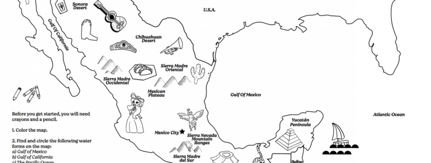
In today’s lesson, we will bring together some of the things you learned about maps, geography, and land and water forms as we explore Mexico. In Mexico, there are many high mountains throughout the country, vast deserts in the north, and lush green rain forests in the south and in the east.

Before you get started, you will need crayons and a pencil.

First, color the physical map of Mexico.

Next, find and circle the following water forms on the map:
1) the Gulf of Mexico
2) the Gulf of California
3) the Pacific Ocean

See if you can also find and circle the following landforms:
1) The Mexican Plateau
2) the Sonoran Desert and the Chihuahuan Desert
3) Sierra Madre Occidental, Sierra Madre Oriental, Sierra Madre del Sur, Sierra Nevada Mountain ranges
4) the Yucatan Peninsula


Download Activity Sheet:


Note to parents

There are a lot of Mexico specific land and water forms to explore in this map.